Monday, April 25, 2016

The Southern Mile of Noland Creek Trail

After being chased by gnats from Goldmine Loop Trail and Tunnel Bypass Trail, we went a mile or so back down Lakeview Drive (the gnats followed us), and hit the last mile of Noland Creek Trail. Noland Creek Trail is approximately 10 miles long, but the last mile, which is an in and out mile for us, so actually 2 miles of walking, was suggested as a separate hike in A Day Hiker's Guide To All the Trails in the Smoky Mountains

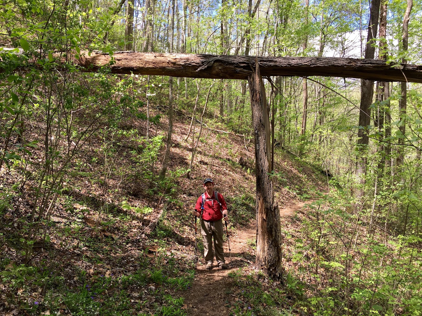
We hit the trail armed with our snake catcher/charmer, and catch a snake he did. It appeared that the garter snake had recently had a meal and didn't try to bite. Whew! He was let go in the same spot he was captured and didn't appear to be all that upset about the temporary hostage situation.


Here's the snake charmer, armed and ready for the next adventure.


We got to the end of Noland Creek Trail and realized that we had stumbled upon a little piece of paradise. Campsite  66 is at the end of Noland Creek Trail, and it is one that we may just have to try out on another occasion. But it is designated as a "boat-in only" site, so we'd have to come at it with some sort of floating device. Hmmm ... There are possibilities ... The Guide Book states that this campsite is heavily used. Campsite 66 is at the end of Noland Creek, which at this point, is not a shabby little creek but a robust medium sized creek that flows into a skinny little arm of Fontana Lake. Fontana Lake was low, as mentioned before, but probably in a month it will be at higher levels. So come summer, I imagine that this tranquil little spot will be a happening place.


Just entering the Fontana Lake area at the end of Noland Creek.


Everyone sighed a collective sigh and spread out to skip rocks, catch some sun, sleep, or soak in the beauty. No one else was back in the area and it almost felt that we were alone in the world.


The navigators navigating ...


We didn't run into any other hikers on this day hike. We caught glimpses of some from a distance, but otherwise, had this trail and the Loop Trails we did earlier in the day to ourselves. Which is nice and not so nice. We really enjoy meeting other hikers. I have a feeling most of them were at more congested trails such as Porter's Creek and those that are known to be filled with wild flowers, as it is that time of year. 


So for the Trip Stats:

Mileage Hiked - 2 miles
New Miles Added to the 900 Mile Challenge: 1 mile
Total Miles Hiked toward the 900 Mile Challenge: 44.7
Miles Hiked that count for the 100 Mile Challenge: 2 miles
Total Miles Hiked for the 100 Mile Challenge: 37.4

As John Muir puts it, "The Mountains are calling and I must go." Until next time ...

Sunday, April 24, 2016

Tunnel Bypass Trail and Goldmine Loop Trail

I think it is safe to say that I am smitten, obsessed, and thoroughly single-minded these days. I follow several Facebook sites that don't help the situation at all. The situation being that I cannot get my mind off the Smokeys nor can I get to the Smokeys nearly enough to satisfy my longings for hiking and exploring. It is a very emotional experience each time I am able to make a trip to the Smokeys, and I think that sums up what we are all feeling as a group.  

So, on our most recent hike this weekend, we saw this bumper sticker on the back of a car parked in the trail head lot to Tunnel Bypass Trail and Goldmine Loop Trail. This is my GOAL!! The journey is  the joy of it, but I SURE WOULD LOVE to be able to have that bumper sticker. It'd be too good for my car ... It will come with time, I know, LOTS AND LOTS of time, as it seems that we are not exactly making great strides in the mileage department. But we sure are having fun!!


This weekend we met up on the North Carolina side of the Smokeys (Deep Creek area) through Bryson City, with my dear sister, who was coming to pick up her kids, who had spent a week with us. It was great to add them to our hike, as well as to have our entire core group all together.


On the way from Chattanooga, we were covered with low clouds and fog for much of the time, but at the trail head, it was perfect, sunny and not too hot. (I'm still trying to figure out how to take selfies with the group. I've been removed from that job, as you will see in subsequent photos.)


We started out at the Road to Nowhere, as it is also known, and walked through the tunnel. The Tunnel Bypass Trail and Goldmine Loop Trail are actually two loop trails, one inside the other. The larger loop, Goldmine Loop Trail, is 2.0 miles in length and Tunnel Bypass Trail is 1.6 miles in length. There was a bit of backtracking we had to do, Lakeshore Trail, 0.6 miles and a bit of Tunnel Bypass trail. Because of the backtracking, we had to hike through the tunnel twice, which was a breeze, literally, and quite a cool one too, I might add. 


My favorite photo of the day:


Unfortunately, humans seem to think that they must leave their mark on everything. The tunnel was covered with graffiti the whole way through. Hopefully the kids weren't looking too closely ...


The obligatory sign photos ...


One of the fireplaces remaining of a settlement on Goldmine Loop Trail. There again was quite a bit of cleared land and signs of human habitation scattered all around, with a creek running through it all.


One of the hallmarks of this hike was all the rest breaks we took. Somebody was constantly hungry and needing a break ... Part of the group took lunch at campsite 67, which was out of our way by 0.3 mile (there and back). No backpackers were seen, so we made ourselves at home:


A finger of Fontana Lake was accessible off Goldmine Loop Trail. It was quite low, as it is part of the TVA and the water level hasn't been raised for the summer yet. But it made for some beautiful scenery and we enjoyed another break taking pictures there. This was our first time hiking near Fontana Lake, but it won't be our last. We will see quite a bit of this lake as time goes on, and we are looking forward to every bit of it.


Most of the group coming up a hill. We were scouting for bears the whole time, no sightings the entire day though.


Relaxing ...


It has been deemed that Nathan is the more progressive selfie-taker and will be covering this part of the job from here on out. A picture speaks a thousand words, and here it is shouting, "He knows what he is doing!!"


So, we finished this hike in no record time, and headed down the road to the next trail, chased by gnats the whole while. Be on the lookout for the next post to follow shortly.

But in the meantime, trip STATS:

Mileage Hiked - 5.3 miles
New Miles Added to the 900 Mile Challenge: 4.3
Total Miles Hiked toward the 900 Mile Challenge: 43.7
Miles Hiked that Count for the Centennial Challenge: 5.6 (counting lunch at campsite 67)
Total Miles Hiked for Centennial Challenge: 35.4

Thursday, April 7, 2016

Schoolhouse Gap Trail and Turkey pen Ridge Part 2 AND IMPORTANT PUBLIC SERVICE ANNOUNCEMENT


I just got these photos from Rod yesterday, and had to include them and tell the stories surrounding them. The previous several posts have our group split up for a short while, and this post covers a bit of what this blogger missed out on, which kills me. I like to be involved in it all. But alas, I have not yet completed my cloning project, so have to pick and choose ...
This part of the hike was completed by Rod, Pam and Chuck just shortly before Matthew and I blazed through, so we didn't get to experience it exactly the way they did. 


Rod's statement regarding this photo was, "We had a tough time crossing some obstacles!!" I recall feeling exactly how Pam looks in the picture, rather stuck; whereas Matthew practically hopped over the fallen tree. It's all in the length of leg ...


I believe they ran into these two ladies on Schoolhouse Gap Trail, before turning onto Turkey Pen Ridge. I remember seeing the lady to the right, but we were on a mission, which did not involve stopping! The lady in the right of the picture is Lynn Schmerber, with Trails Forever, a volunteer organization whose member's duties include hiking the trails to report problems to trail maintenance crews and other volunteers. Her companion on the left is Amy Logan.


Rod wanted to pass along some information that Lynn had requested to be posted in our blog, which I heartily second:

USE THE TURNOFFS ON THE SIDE OF THE ROAD.

I am referring to driving in a vehicle in the Park. The Park is large, and many drivers have a particular destination in mind and don't really have time to lolly-gag behind a slowpoke rubbernecker taking photos every ten feet out of their car's sunroof. Yes, the drives are exquisite, beautiful scenery is everywhere and drivers don't even have to get out of cars to feel the beauty.

But it is maddening to be in a long line of cars following that one car from Virginia (you know who you are) going 10 mph UNDER the speed limit. AND passing turnoff after turnoff, where they could have stopped to take photos to their heart's content while the lineup of cars behind them was able to go by at the speed limit.

Pass this along ... whew! I feel better. 

Sunday, April 3, 2016

White Oak Sinks

See the blog post here, for a further account of the events that led us to White Oak Sinks. The day of our hike was the first day the Sinks were opened to the public for the year. Below is Matthew and myself just before heading down into the White Oak Sinks:


We went on down, down, into the Sinks. See the very interesting article here, for more information on the Sinks.

Matthew is a natural guide, and remembered from a previous trip into the Sinks, where a yellow lady slipper is located and took me right to the location, although the flower is not in bloom.


A picture does not do this place justice, below is a sink hole, one of many that makes up the Sinks.


Another sink hole ... typically loaded with flowers. Although there were may flowers blooming, I was told by Lisa that the wildflowers are not in full bloom, probably another two weeks will be peak.


There are many signs of human habitation scattered throughout the Smokies, in places that seem so far "out of the way," such as the Sinks, as to be uninhabitable.  But the signs are everywhere ... Matthew brought us to this spring, now dried and unproductive.


Rock wall ...


Old stove parts?


Creeping Phlox and Yellow Trillium


Shooting Star


Wild Geranium


The several caves in the White Oak Sinks were all closed, due to the declining bat population from White Nose Syndrome. Ken and Lisa were in front of me in this photo, and in front of them can be seen the area blocked off by Blow Hole Cave with orange fencing. It did not lend to the scenery, but if it protects the bats, then so be it. 


This is the entrance to Blow Hole Cave, and as you can see, a solar panel is in the tree. I wondered about that, and after we met up with the rest of our group, was told the following:

They had spoken w/ a park volunteer on School House Gap Trail who said that the closed areas are under video surveillance sent directly to the ranger stations. If anyone violates the closure, they are stopped by rangers at the top of the trail and handed a fine of $250 - $500. The closure is a serious business and not to be taken lightly.


Bloodroot


One of my favorites, a fiddle-head ...


Bloodroot


Just popping through, May Apples ...


Phlox


Yellow Trout Lily


Star Chickweed


A grave site is on top of a little rise in the Sinks. A new headstone sits beside the barely decipherable headstone of Abraham Law, 1790 - 1864.


Interestingly, we ran into some hikers referenced in my previous post, Joe Cook and daughter Victoria Cook, who had spoken with a great-great-great descendant of the deceased the day before. They were told by him that the date of death was wrong, it was actually 1844, 20 years previous to 1864. That was interesting to me, as Matthew and I had discussed that 74 years of age seemed to be "pretty old" for back in this day, time, and place. Apparently the family who had brought the headstone in didn't feel like carrying it back out after they found out the error.


Redbud Flower


After an hour and a half wandering around the Sinks, we made it back out. It was completely worth the extra 2 miles of trail that can't be counted toward the 900 Mile Challenge (but I can count it toward the 100 mile centennial challenge). Here is the entrance to the trail, to keep horses out.