We chose Grapeyard Ridge/Baskins Creek Trail to see if we could find any fire damage and check out any new growth, although admittedly, it is still February. The forecast called for rain, and we came prepared. It's that time of year. A friend of Recal's, Dan, joined us from Colorado, where the elevation is a few thousand more feet than the Smokey's. Dan shortened Recal's name to "Mr. PeeBody." It's more descriptive and fitting.
So here we are at the beginning of the trail, all stoked and ready for a great hike.
Unknowingly, we were walking through rattlesnake and copperhead territory, although surely they weren't feeling too inspired to sun on any rocks this time of year. We hadn't read the Guidebook and forgot to take it on the hike with us, although we had our maps and GPS. So this post will be an attempt to catch up our group on what we missed by briefly summarizing the Guidebook.
The Guidebook says that there were several homes in the area where the trail began, one owned by Avery Whaley included 61.8 acres and was sold to the park in 1929 for $1,750. There was evidence all around of human habitation, although we did not see any standing structures until the end of the trail.
Dolly Parton's grandfather, Walter Parton, lived above Porter's creek, which we crossed over a number of times.
It was also a "thing" to collect Fraser fir sap, which was used as a remedy for burns and cuts, and Andy Rayfield, who lived in James Gap area, tapped the fir sap and sold it for 75 cents a pint.
The rain held off for a good while ...
At James Gap the remains of a steam engine tractor that overturned into the creek in the 1920's can be seen. It was brought in to saw timber for a new school and got a wee bit too close to the edge. The driver was not injured in the wreck. The creek it landed in is called Injun Creek, which wrongly is thought to refer to the Native American's living in the area.
Manufactured in Battle Creek, MI. A long way from home ...
We paused for lunch here and ran into Megan-without-an-H and Gary. Mr. PeeBody must have their picture on his phone. We always enjoy meeting fellow hikers.
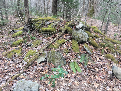
This must be the site of the Preston Ogle place, who owned 123 acres, a tub mill, 38 apple trees, a two-room log cabin (the foundation looked pretty big), and a barn. He was given $1,900 for his property in 1929 when his land was purchased for the national park.
Early blossoms ...
Trail obstruction ...
Grapeyard Ridge Trail ended in a clearing with a cabin, barn and outbuilding owned by Alex Cole, who lived in a different dwelling in Sugarlands area. He was given $2,100 for his property and a lifetime lease. Mr. Cole got a splinter in his hand, the resulting infection cost him the sight in one eye and his hand, which had to be amputated. Aren't we blessed to have antibiotics? (even if they are overprescribed).
A good hike cures what ails 'ya ...
We reached the start of Baskin's Creek Trail, a 2.7 mile long trail headed to the Roaring Fork Nature trail area. The Guidebook states that this trail is rarely traveled due to the "cryptic location of the trailhead." Makes one want to hike it all over again to remind oneself what was so cryptic about the trailhead.
We were immediately greeted by this cemetery.
Shortly after we ran into the first signs of the recent fires. The faint smell of burnt wood could still be detected.
An unmaintained side trail that led to Baskin's creek trail appeared to have been in the middle of the firestorm. It was a trip worth taking, even though it didn't count toward mileage.
Baskin's Creek Falls looks like it can be a lot more intimidating than it was when we encountered it. There was a large pile of logs at the bottom of the falls that could only have come from above. It was hard to imagine that with the amount of flow, however pretty, that was coming over when we saw it.
The Guide book says that members of the tiny Baskin's Community, formerly located just downstream, used the falls for taking showers.
The remainder of Baskin's Creek Trail looked to be heavily involved in the firestorm that blew through the Smokey's in November of 2016. We did not notice any new growth, but it is just February. That will be most enjoyable to witness.
Dusk was on us and the photos didn't do the scenery justice. There was quartz rock scattered through-out the woods, and the contrast was sobering and beautiful all at once. It would have been nice to see that in the sunshine.
We missed a cemetery at the end of the trail. Guess we'll have to go back.
Trip STATS:
Total Mileage hiked: 10.4 miles
Mileage Added to 900 Mile Challenge: 10.4
Total Miles Hiked Toward 900 Mile Challenge: 115.2
Total Miles Hiked in the Smoky's: 137.8 miles


